Storms couple with downpours

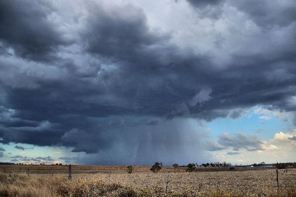
The first of a series of storms began mid afternoon. Photo: Terry West.

By ALENA HIGGINS

LIGHTNING strikes lit up the night sky on Tuesday as a severe storm passed through the region bringing strong winds and driving rain.
While the storm, which began earlier in the day, brought only moderate falls to most parts of the district, some farmers in Maryvale were blessed with 34mm of desperately needed rain.
Killarney received the next highest soaking, recording 14mm in the gauge, while Warwick was not far behind on 13mm, followed closely by Tenterfield 12mm, Allora 10mm and Stanthorpe 5.7mm.
Bureau of Meteorology (BOM) senior forecaster Bryan Rowstone said the Southern Downs could be in for more rain with potential storm activity predicted over the remainder of the week.
He said like the falls seen on Tuesday, the amount of rain would be “highly variable”.
Free Times photographer Terry West was in Junabee, east of Warwick and captured some of the massive bolts about 7.30pm and corroborated the rain’s unpredictability.
“The BOM issued a severe strom warning for these storms and they dumped a mass of rain on some properties,” he said.
“Unfortunatel, you needed to be under the right cloud to get the rain.”
Mr Rowstone said while this summer season was forecast to be dryer than average due to the El Nino effect, it would only take one heavy random rainfall to bolster reserves.